GIS-based Estimation of Geothermal Potential
GIS-based Estimation of Geothermal Potential
With a geographic information system (GIS), field data can be georeferenced, processed, edited and digitally visualised. This offers countless possibilities, including the estimation of geothermal potentials for shallow geothermal systems, based on soil maps, and the integration of geological and hydrogeological information.
Based on such pedotransfer functions, the working group Shallow Geothermal Energy determines essential system parameters for potential estimates of shallow, earth-coupled heat exchanger systems. The thermal soil properties parameters determined here can also be used for heat transport calculations within the environment of underground high-voltage transmission lines (see underground cables).
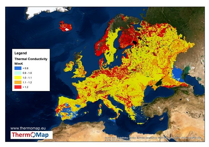
We realize GIS-based analyses on a municipal level in cooperation with local authorities, but also on (inter)national level. For example, within the framework of the EU project ThermoMap, very shallow geothermal potentials in Europe are mapped. This interactive map is available at:
www.thermomap.eu
Contact
-
Erarbeitung eines Handlungsleitfadens zur Abschätzung der oberflächennahen geothermischen Potentiale in ländlichen Gemeinden
(Third Party Funds Single)
Term: 1st August 2019 - 31st December 2020ab


